Chichen Itza ("Mouth of the well of the itzaes") is one of the most controversial, studied and visited ruins of the mayan world. Its history and its chronology are the subject of debates and the fate of its people a puzzle that archaeologist continue to theorize about as excavation continue. The Itzaes settled in Chichen Itza in the IX Century a.C. forging a wide empire with one culture centered in Chichen Itza. Around 1250 a.C. the city was abandoned for reasons still not completely understood (the travel guide believes that drought and a revolt by the under class over the upper class was the main factors). In its Golden Era, Chichen Itza covered an area of over 25 square kilometers. The religious, cultural and administrative center covered approximately 6 square miles and was located close to the area where the elite resided in carefully decorated and brightly painted palaces. Around this central area lived between 50,000 and 100,000 people in thatch-roofed palapas or cottages.
Enough with the history lesson, more information about the Mayan civilization can be found here . On to the pictures...
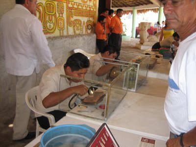
 Along the way to the ruins we stopped at a Mayan shopping area. So while there are still Mayans living in the Yucatan their civilization is long lost. Being the sucker tourists that we are we all bought pendants with our names spelled out in Mayan hieroglyphics. The tour guide told us that all proceeds of our purchase go directly to the Mayan people and the quality of the gold and sliver is backed by the Mexican government.
Another stop found us at one of many sink holes in the Yucatan region. These "watering holes" were formed naturally throughout the region and were a source of water for the Mayan civilization.

Finally to the ruins! Shortly after arriving we were greeted with cloudy weather and a brief shower of rain. Being burnt from head to toe I was thankful for the lack of sun.

Temple of the Observatory. The Mayans were keen astronomers because of their worship of the sun. They developed a 365 day calendar long before Europe and the Gregorian calendar.

Temple of the warriors and Square of the 1,000 columns. Believed to be a market place and similar in design to other ancient market places of the time.


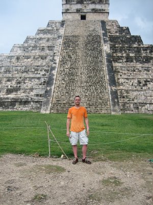
The Castle of Kukulcan rising 30 meters from the earth is the most impressive building. It's age is difficult to calculate, being estimated between 650 and 800 a.C. The numbers of its different measurements relate to digits in the maya solar calendar; for example, 91 steps on 4 sides, or 364; plus the platform, 365, the number of days in a year. The five adornments on each side of the temple are 5 X 4 or 20, the number of days in a maya month. The building, revealing the profound knowledge of the mayas, every year during equinox demonstrates the descending of the god Kukulkan, "The Feathered serpent", to earth, in a light and shadow phenomenon that every year attracts visitors from all over the world.

Timmy and I in front of the north side of the temple in front of the head of the god Kukulkan. As you can see the transformation into Lobster Boy is nearly complete.

One last shot of me in front of the castle soaked from the recent rain. Unfortunately we were unable to climb to the top of the castle as it has been restricted since an accident involving a tourist who fell to her death from the structure.
Still to come: boating to the coral reef, shopping, more shopping, and even more shopping. Did I mention we did some shopping?
No comments:
Post a Comment